
Crook Hill Walk: Landscape Photography Above Ladybower
A four-mile loop, bracketing and a long exposure at duskLast updated: October 2026
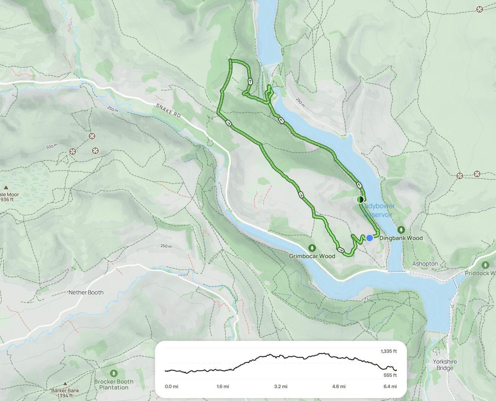
The Crook Hill walk from Ladybower Reservoir is a four-mile loop in the Peak District, and it’s a great short walk for landscape photography. I did it with my wife and our dog Bonnie, finishing with a long exposure of the traffic crossing the bridge over Ladybower as the light dropped.
Here’s the route, the settings I used and a few lessons from walking back in the dark.
Crook Hill walk from Ladybower Reservoir at a glance
| Area | Crook Hill, above Ladybower Reservoir, Peak District |
|---|---|
| Distance | About 4 miles, circular |
| Time | About 2 hours |
| Kit | Canon 5D Mark IV, 24 mm prime, 24–105 mm, Benro Tortoise tripod |
| Techniques | 7-shot exposure bracket; 25–30 second long exposure at dusk |
| Dogs | On a lead: the fields are full of sheep and lambs |
| Files | 7 RAW files, 2 GPX files and the car park location on my Patreon |
Ladybower’s drowned villages
Under the water at Ladybower lie the villages of Derwent and Ashopton, flooded when the reservoir was built. At the start of the walk there’s a picture from 1941 showing the viaduct and the village. It looks absolutely bizarre. A whole village, now home to the fish.
The walk up
The forecast promised rain, but it held off. It was cloudy and overcast, which is ideal for landscape photography.
From the car park we took a right and headed up, with the GPX route loaded on my watch. With three lenses and a couple of bottles of water in the bag, it’s a bit of a pant up the hill. Bonnie, carrying nothing, found it easy. Within 15 minutes I’d taken my coat off. Then, as soon as we stopped, I cooled right down and it went straight back on. Repeat all afternoon.
The fields are full of livestock, with ewes and lambs everywhere, so Bonnie went on the lead. Safety first.
Shot one: a 7-exposure bracket
I set up the Benro Tortoise, a full carbon tripod without a centre column that’s light and quick, with the Canon 5D Mark IV and my 24 mm prime.
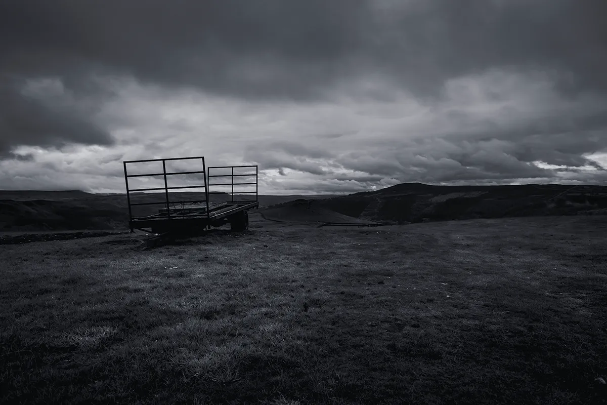
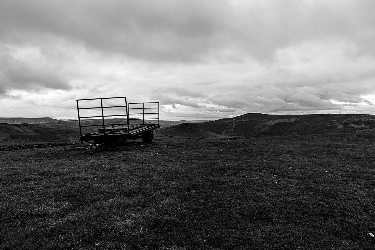
The scene had a big range of light, so I bracketed seven shots: ISO 100, f/9, a base exposure of 0.3 seconds, manual focus. I blend them in Photoshop on layers when I get home. I’m not a massive fan of HDR, but it’s there if I want it. Like a spare tyre.
Running out of daylight
Crook Hill looked fantastic ahead of us, but we were short on daylight and had to pick our lad up in an hour, an hour’s drive away. So we didn’t make the top this time. I’ve done it before, and it’s definitely one to come back to for a timelapse.
Then the sheep surrounded us. Normally they’re terrified, but these didn’t care about the dog at all and came within punching distance. I think they thought my bag was full of food. They weren’t entirely wrong.
Shot two: long exposure of the bridge
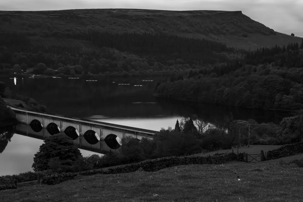
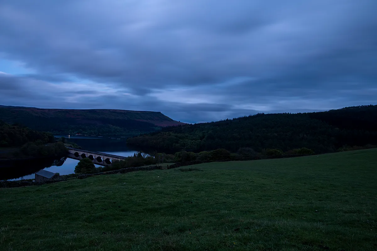
The last shot of the day was a long exposure looking at the bridge over Ladybower, timed for cars crossing it to leave light trails.
- First go: 24 mm, f/14, ISO 50 and one stop under, for 25 to 30 seconds. With the light dropping I didn’t need my Lee filters. I used the timer so my hands weren’t on the camera when it fired.
- Second go: I wasn’t feeling it with the 24 mm, so I switched to the 24–105 mm at around 60 mm for a tighter crop of the bridge, and waited for cars to come off it.
Walking back in the dark
We walked back in the dark. The GPX file on my Garmin was fantastic all the way round. It beeps if you go off course, and it’s accurate: up on Derwent Edge there’s a spot where several paths meet, and it showed exactly which one to take. We only came unstuck once, when we couldn’t find a gate at the bottom of the edge, which cost us two or three minutes.
Charge your watch fully before you go, because the GPS drains it. And carry a head torch: I use a Petzl Tikkina.
Question: what boots do you wear?
My Salomon Quest 4s have always been slippy on rocks, and they’ve now got a few cracks. I’m looking for a full-size boot with proper ankle support, because I carry a lot of weight. Not a mountaineering boot, but a proper four-season walking boot. Tell me what you wear and what it cost.
The kit I used on this walk
- Camera: Canon 5D Mark IV
- Lenses: Canon EF 24mm f/1.4L II and Canon EF 24-105mm f/4L
- Tripod: Benro Tortoise TTOR35C
- Filters (not needed at dusk this time): LEE100 system
- Boots: Salomon Quest 4 GTX
- Head torch: Petzl Tikkina
- Navigation: GPX route on my Garmin watch
Everything else I carry is on my wild camping and photography kit list.
Supporting files on Patreon
Everything from this walk is on my Patreon, so you can follow the route and edit the shots yourself:
- The 7 RAW files from the day, including the full 7-shot bracket and both bridge long exposures
- 2 GPX files for the Crook Hill loop, to load onto your watch or phone
- The car park location
Get the RAW and GPX files on Patreon
Tips for the Crook Hill walk
- Keep dogs on a lead in the fields, especially in lambing season.
- Layer up and down. You’ll overheat climbing and cool fast when you stop.
- Leave time for the top. We ran out of daylight before the summit.
- Stay for dusk for long exposures of the traffic crossing the bridge.
- Carry a head torch and a charged GPS for the walk back.
Crook Hill walk FAQ
How long is the Crook Hill walk?
About four miles in a loop, taking around two hours. Allow longer if you’re stopping for photos or want to reach the top.
What settings did you use for the long exposure at Ladybower?
About 25 to 30 seconds at f/14 and ISO 50, one stop under, on a tripod with the timer. As the light dropped I didn’t need any filters.
Are dogs allowed on the Crook Hill walk?
Yes, but keep them on a lead. The fields are full of sheep and lambs.
What is under Ladybower Reservoir?
The villages of Derwent and Ashopton, flooded when the reservoir was built.
Keep reading
 The kit I carry
See what makes the rucksack
Every tent, sleeping bag, layer and lens I trust, with honest reviews of each.
Planning a Peak District walk?
Tell me where you’re heading and I’ll tell you what I’d take.