
Baitings Dam Low Water: The Old Packhorse Bridge Revealed
Drone footage of a hidden bridgeLast updated: October 2026
On Saturday evening, 12 July, I walked up onto the moor above Baitings Dam with my DJI Mavic 2 Pro. The dry summer had dropped the water so low that the old packhorse bridge, normally hidden under the reservoir, was standing in the open. My socials were full of low reservoirs across Yorkshire, and I wanted to see Baitings Dam from above.
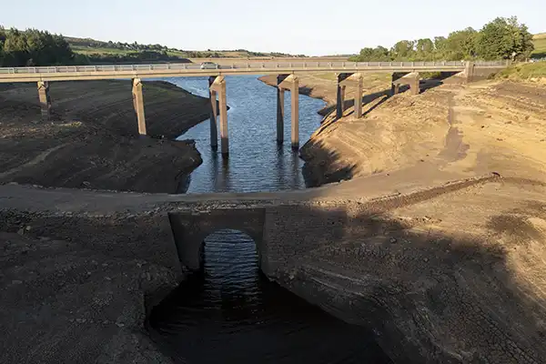
Baitings Dam at a glance
| Where | Baitings Reservoir, near Ripponden, West Yorkshire |
|---|---|
| What was revealed | An old stone packhorse bridge, usually under water |
| Shot on | DJI Mavic 2 Pro |
| Watch out for | Power lines and pylons around the reservoir |
The packhorse bridge
Packhorse bridges like this one carried trains of pack horses and their loads across the Pennines long before the reservoir was built. Seeing it standing clear of the water, surrounded by cracked, dried mud, was like looking at a different landscape. A dry Yorkshire summer: rarer than you’d think, and apparently good for archaeology. From above, the cracks formed patterns I’d never have seen from the ground.
For once, my 5D Mark IV stayed in the bag. This was a job for the drone. The camera took it well.
Flying safely
Baitings is surrounded by pylons and power cables, and the wind around the moor is gusty. I kept the drone low and well away from the lines, kept checking its position, and had return-to-home set up in case I lost signal or the battery ran low. If you fly here, plan your flight, stay well clear of the cables and check the rules for the area before you take off.
A reminder about water
Low reservoirs make for striking photos, but they’re a sign of how dry the summer was. If you visit, stay off the exposed mud, which can be soft and dangerous, and respect any closures.
Walking at Baitings Reservoir
You don’t need a drone to enjoy Baitings. Yorkshire Water have two waymarked walks from the free car park (postcode HX6 4LR), just off the A58 at the north-east corner of the reservoir, about 2.5 miles west of Ripponden.
- The short walk: about 1.4 miles on a wide, surfaced path through the woods, with views over the moors and down the valley to Ryburn Reservoir.
- The long walk: about 2 miles, with a steep climb, stiles and steps, and ground that gets boggy after rain. Boots, not trainers.
Whichever you pick, it’s the same view at the end: a lot of water, or in a dry summer, a lot of mud and an old bridge.
Verdict
Baitings Dam at low water was one of the most unusual things I’ve filmed. Not many bridges spend most of their life underwater and still turn up looking this good. The old packhorse bridge won’t be on show for long once the rain returns, so if you get the chance, see it, from a safe distance. For more aerial work, see my DJI Mavic 2 Pro review.
Baitings Dam FAQ
Where is Baitings Dam?
Baitings Reservoir is near Ripponden in West Yorkshire, on the A58 towards Littleborough.
What is under Baitings Reservoir?
An old stone packhorse bridge, which appears when the water level drops very low.
Can you fly a drone at Baitings Reservoir?
Take great care: there are power lines and pylons around the reservoir. Check local rules and stay well clear of the cables.
Is there parking at Baitings Reservoir?
Yes. There’s a free Yorkshire Water car park just off the A58 at the north-east corner of the reservoir (postcode HX6 4LR).
How long is the walk at Baitings Reservoir?
Yorkshire Water’s short walk is about 1.4 miles on a surfaced path; the long walk is about 2 miles with a steep climb and stiles.
Keep reading
- DJI Mavic 2 Pro review
- GoPro Hero 12 Black review
- Canon 5D Mark IV review
- Benro Tortoise TTOR35C tripod review
Want the full picture? Everything I carry is in my wild camping kit list, and the 3-season vs 4-season gear guide explains what to take when.
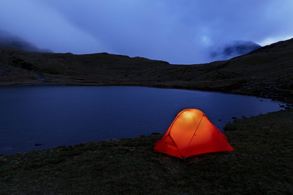 The kit I carry
See what makes the rucksack
Every tent, sleeping bag, layer and lens I trust, with honest reviews of each.
Planning a drone shoot?
Tell me what you’re planning and I’ll tell you what I’d take.